KABAR-GARUT.COM – The Meteorology, Climatology and Geophysics Agency (BMKG) officially withdrew its tsunami early warning status after an earthquake measuring 7.7 magnitude rocked the Mindanao region, Philippines, on Monday (8/6/2026) morning.
Even though the epicenter of the earthquake was in the Philippines, the shock and threat of a tsunami also had a significant impact on several areas in Indonesia that directly border the country, especially in the North Sulawesi area and the surrounding islands.
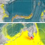
This early warning status was officially declared to have ended at 10.15 WIB, following observations which showed that there was no longer a dangerous rise in sea levels in Indonesia’s coastal areas.
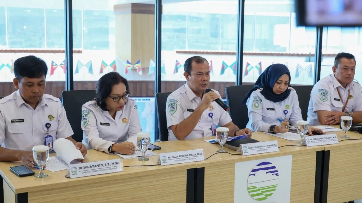
The head of BMKG, Teuku Faisal Fathani, explained that the earthquake which occurred at 06.37 WIB was centered in the sea, around 244 km northwest of Karatung Island, North Sulawesi, with a depth of 47 km. This phenomenon is triggered by plate subduction activity with a thrust fault mechanism.
Also Read: Truck Loaded with 8 Tons of Rice Falls into Garut’s Cikandang River, Six Victims Taken to Hospital
Tsunami Traces on the Border Coast
As a result of the location of the epicenter close to national borders, a number of coastal areas in northern Sulawesi and the surrounding islands experienced the impact of rising sea levels.
“Because its location is very close to Indonesia’s territorial borders, this earthquake triggered an increase in sea level at several points on our coast. We recorded an increase in Loloda, Ulu Siau, Melonguane, Tahuna, Paleleh, Tanjung Sidupa, Bitung, Ternate, to Talengan, which recorded wave heights reaching 0.75 meters,” explained Faisal at the MHEWS BMKG Building, Jakarta, Monday (8/6/2026).
Impact of Damage and Aftershocks
On the other hand, BMKG Deputy for Geophysics, Nelly Florida R., revealed that the earthquake shaking which was centered in the Philippines was felt very strongly even in the land area of Indonesia which directly borders it. The Miangas and Melonguane regions were one of the most affected by intensity VI MMI, which resulted in building damage such as falling wall plaster and damage to factory chimneys.
Meanwhile, the Siau and Tagulandang areas felt the intensity of V MMI, which caused items in the house to fly. Lighter shaking (III-IV MMI) was felt in Manado, Ternate, Gorontalo, and Palu, which woke residents from their sleep.
“Until 10.00 WIB, 20 aftershocks were recorded with magnitudes varying from 3.9 to 6.7,” added Nelly.
Also Read: BGN Corruption and Immigration Scandals Surface, Gatot Nurmantyo Touches on Allegations of Structural Sabotage
Safety Advisory for Residents
BMKG Earthquake and Tsunami Director, Wijayanto, reminded residents in affected border areas not to rush back into their homes or buildings.
“Make sure the building structure is safe. If there are still cracks or damage to the walls and roof, please do not enter directly. Your safety is a priority,” advised Wijayanto.
Currently, BMKG has deployed a team of experts to carry out macroseismic (damage distribution) and microseismic (aftershock monitoring) mapping in the field. Coordination with local governments and related stakeholders continues to be strengthened to survey the impact of further damage.
BMKG urges the public to remain calm but alert, and not to be taken in by hoax information. The public is asked to always monitor developments in official information through official BMKG channels, such as the website inatews.bmkg.go.id, the InfoBMKG application, or official BMKG social media.
“We continue to be on standby 24 hours. Let’s make mitigation a culture in order to realize zero victims in every potential disaster,” concluded Faisal.***